


 Scan Me With Your Phone's Bar Code Reader App


| MONTGOMERY COUNTY NEW YORK REGIONAL NWS SEVERE WEATHER ALERTS |
Left click to see a larger image.
|
|

|

|
| Radar/Satellite image credits can be found here. | |
|
METRIC |
IMPERIAL
|
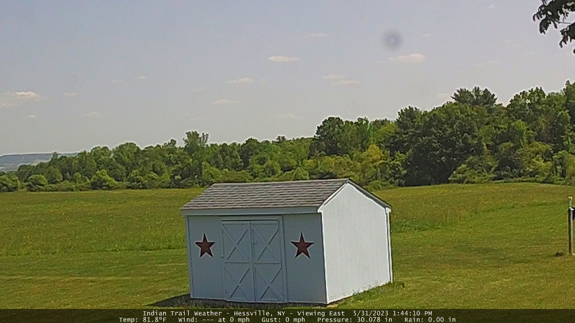
Updated: 02-Mar-2024 @ 7:55pm (0 sec ago) | |||||||||||||||||||||||||||||||||||||||||||||||||||||||||||||||||||||||||
| Temperature | Current Conditions | Forecast / Storm Prediction | ||||||||||||||||||||||||||||||||||||||||||||||||||||||||||||||||||||||||
|
|
|
||||||||||||||||||||||||||||||||||||||||||||||||||||||||||||||||||||||||
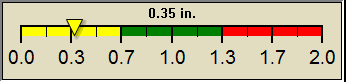
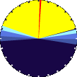
| Dew Point | Liquid Precipitation | Wind Speed | Sun/Moon | |||||||||||||||||||||||||||||||||||||||||||||||||||||||||||||||||||||||
|
|
|
|
|||||||||||||||||||||||||||||||||||||||||||||||||||||||||||||||||||||||
| Humidity | Barometer | |||||||||||||||||||||||||||||||||||||||||||||||||||||||||||||||||||||||||
|
|
|||||||||||||||||||||||||||||||||||||||||||||||||||||||||||||||||||||||||
| Heating Degree Days | Snow3 | Wind Chill | Air | |||||||||||||||||||||||||||||||||||||||||||||||||||||||||||||||||||||||
|
|
|
|
|||||||||||||||||||||||||||||||||||||||||||||||||||||||||||||||||||||||
| Current UV Index | Current Solar Energy9 | |||||||||||||||||||||||||||||||||||||||||||||||||||||||||||||||||||||||||
|
|
|||||||||||||||||||||||||||||||||||||||||||||||||||||||||||||||||||||||||
| Soil Conditions8 | Irrigation Index5 | Station All Time Records | Cloud Level | |||||||||||||||||||||||||||||||||||||||||||||||||||||||||||||||||||||||
|
|
|
|
|||||||||||||||||||||||||||||||||||||||||||||||||||||||||||||||||||||||
|
METRIC |
IMPERIAL
|
Updated: 02-Mar-2024 @ 7:55pm | |||||||||||||||||||||||||||||||||||||||||||||||||||||||||||||||||||||||||


| 1 Rain season: Jan 1st to Dec 31st. 2 Snow season July 1st to June 30th. 3 Snow manually measured usually around 7AM and 7PM. 5 Estimated amount of water needed to replace the water used by plants and evaporation from the past week. (Negative numbers mean amount of water needed, positive numbers mean excess water is present). 6 NowCast Air Quality Index µm2.5 is provided by Indian Trail Weather, Hessville, NY, using a Davis Airlink 7210. 7 Leaf Wetness is surface moisture on foliage. 0 being totally dry and 15 being totally saturated. 8 Soil moisture and temperatures are from sensors burried in the ground at the levels specified. 9 Solar Index represents either an absolute scale of solar energy (W/m²) using the station’s recorded maximum or a percentage of computed theoretical solar maximum using the station’s location and time of day. These indices differ most when the sun is low on the horizon. The current scale is shown, and will toggle if it or the icon is clicked. 10 Historical average only to day 17 of just the month of July for this station since 2005. 11 Historical average rain this season to day 17 of July for this station since 2005. |
| NWS Weather Forecast - Outlook This Afternoon & Tonight | ||||||||||||||
|
||||||||||||||
|
||||||||||||||
|
||||||||||||||
|
ajax-dashboard6.php - Version 6.95h - 20-Feb-2023 - Script by: Scott of BurnsvilleWeatherLIVE.com Now supported by Saratoga-weather.org Download |
||||||||||||||


| TODAY IN WEATHER HISTORY |


© 2026, indiantrailweather.com |
Weather-Display (10.37S-(b147)) |
Valid
XHTML 1.0 |
Valid CSS
Never base important decisions on this or any weather information obtained from the Internet.
Never base important decisions on this or any weather information obtained from the Internet.